
Stanton ZIP Codes and Their Reach
A postal code is a delivery route, not a city polygon. The Stanton postal directory therefore has to show postal coverage and municipal context in the same table. The research identifies one core ZIP and two edge examples. It does not support a claim that every parcel inside a ZIP falls in Stanton, or that every Stanton parcel uses the city’s principal ZIP.
| ZIP code | Areas covered | Post office or label | Local note |
|---|---|---|---|
| 90680 | Core Stanton area | Stanton Post Office | Principal Stanton residential and business ZIP |
| 92804 | Small north or east Stanton fringe | Anaheim postal city | Stanton city documents label an example at Magnolia Avenue |
| 92841 | Small south or east Stanton fringe | Garden Grove postal city | Stanton city documents label Beach Boulevard examples |
The Stanton Post Office is at 10440 Beach Boulevard, Stanton, CA 90680-9998. The official locator lists 714-826-8830, retail hours Monday through Friday 8:30 a.m. to 5 p.m., and a PO-box lobby Monday through Friday 6 a.m. to 6 p.m. and Saturday 6 a.m. to 5 p.m. Services include carrier and general delivery, PO boxes, passport appointments and photos, fingerprinting, and in-person proofing.
Note: Postal service hours and delivery labels should be checked again before a counter visit or address match.
Verify a Stanton ZIP With USPS
The USPS ZIP Code Lookup is the right first check when a street spelling, city label, or ZIP code is uncertain. It normalizes a deliverable address and returns the postal ZIP. That answer belongs beside, not in place of, the county parcel result. Use the returned ZIP to select the right branch of a search, then confirm the APN and legal jurisdiction in Orange County systems.
| USPS lookup field | What to enter |
|---|---|
| Street address | House number, street name, and unit when applicable |
| City and state | Stanton, Anaheim, or Garden Grove label as supplied by the address |
| ZIP result | Five-digit ZIP returned for delivery |
| ZIP+4 result | More precise delivery segment when USPS supplies it |
USPS can answer where mail is routed. It cannot answer who owns a parcel, who is registered to vote, or which city department holds a permit. Verify those questions with the appropriate custodian.
The USPS address-to-ZIP screen provides the postal key used in the next step.
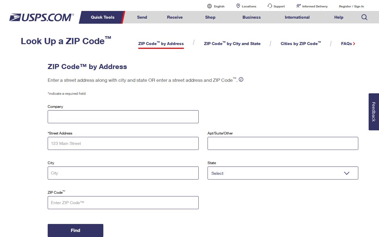
The USPS result helps preserve the exact postal form before a county address or APN search begins.
Finding Stanton Residents by ZIP Code
A postal directory search works best as a narrowing step. County portals do not all support a public ZIP-wide resident search. The tax and GIS tools are primarily address, APN, or parcel tools. The voter self-lookup is identity-gated. Restricted voter-file products can be requested only for approved purposes and cannot be repurposed as a public neighbor list. Use ZIP geography to sort a known set of addresses, not to promise a complete roll.
- Verify the address and ZIP with USPS, preserving the postal city label exactly.
- Use the Orange County tax search to resolve the address to an APN and situs.
- Open the APN in OC GIS and note the parcel, adjacent lots, and municipal context.
- Use the recorder, court, permit, directory, or vital source that answers the actual question.
- Move to the Stanton street directory once the ZIP has narrowed the search to a street or parcel.
The phrase “residents by ZIP code” should therefore be read as a research method. It does not mean the county publishes a single public database of every person living in 90680, 92804, or 92841.
Stanton ZIP Edges and City Limits
Stanton’s documents provide concrete edge examples. The city packet labels 10560 Magnolia Avenue as Stanton, CA 92804, even though 92804 uses an Anaheim postal city. It also labels 12631 through 12813 Beach Boulevard as City of Stanton addresses with 92841, even though that ZIP uses a Garden Grove postal city. These are not abstract boundary warnings. They are reasons to preserve both postal and municipal fields.
When a ZIP result and a city result appear to conflict, compare the APN, tract or lot, parcel map, city facilities map, and address record. Do not change a city name just because the USPS label differs. Do not assume the city name proves the ZIP. The legal parcel and the custodian jurisdiction control the record request.
Boundary rule. Use USPS for delivery, Orange County GIS for parcel geography, and Stanton or county custodians for municipal records.
Note: A postal city can guide delivery while the parcel record controls municipal research.
ZIP Code Terms for Stanton Searches
Several postal terms can sound like record types. They are not. Define the term before using it as a search filter.
- Postal code
- A five-digit USPS delivery area used to sort and route mail.
- ZIP+4
- A four-digit extension that can narrow delivery within a five-digit ZIP.
- PO-box ZIP
- A ZIP assigned to a post-office box service area; it may not describe a street parcel.
- Unique ZIP
- A ZIP assigned to a single organization or limited institutional use, not documented as a separate Stanton ZIP in this research.
- Carrier route
- A delivery sequence used by USPS, which is more specific than a city name but is not an occupant directory.
Stanton’s 90680 core should not cause a searcher to discard 92804 or 92841 edge examples. Conversely, a postal code alone should not be used to merge neighboring postal communities into Stanton.
Parcel Geography Beats Postal Shortcuts
Stanton’s roughly 3.1-square-mile footprint makes parcel precision especially useful. Major east-west roads include Ball, Cerritos, Katella, Orangewood, Chapman, Lampson, and Garden Grove Boulevard. Beach, Dale, Knott, Western, and Magnolia run north to south. Flood channels, rail alignments, freeway edges, and dense multi-unit parcels can split a postal search in ways a five-digit code cannot show.
The final map checklist calls for subdivision boundaries, lot and block lines, street centerlines, monuments, easements, city boundaries, streets, alleys, highways, and numbered or lettered parcels. Those fields explain why the APN, tract, lot, and legal description remain valuable when a street label or postal city changes.
Stanton ZIP-Keyed Public Records
Orange County voter data is “NOT public data” in the documented application. A county product can involve registration dates, selected election history, district, product choice, applicant identity, authorized purpose, wet signature, and payment. The active file can contain residence and mailing fields, but the county excludes driver-license data, Social Security data, unique identifiers, signatures, images, and ballot choices. Treat a ZIP as a geographic filter only where a custodian expressly allows it.
State tools also remain evidence-specific. The Controller’s unclaimed-property search asks for a last or business name or property ID, with first name and city optional. It can produce a claim lead, not proof of a Stanton address. The same caution applies to professional licenses, business filings, court results, and custody portals. Use the record for its stated purpose.
The California unclaimed-property search is a free name-based lead that should be verified through the State Controller.
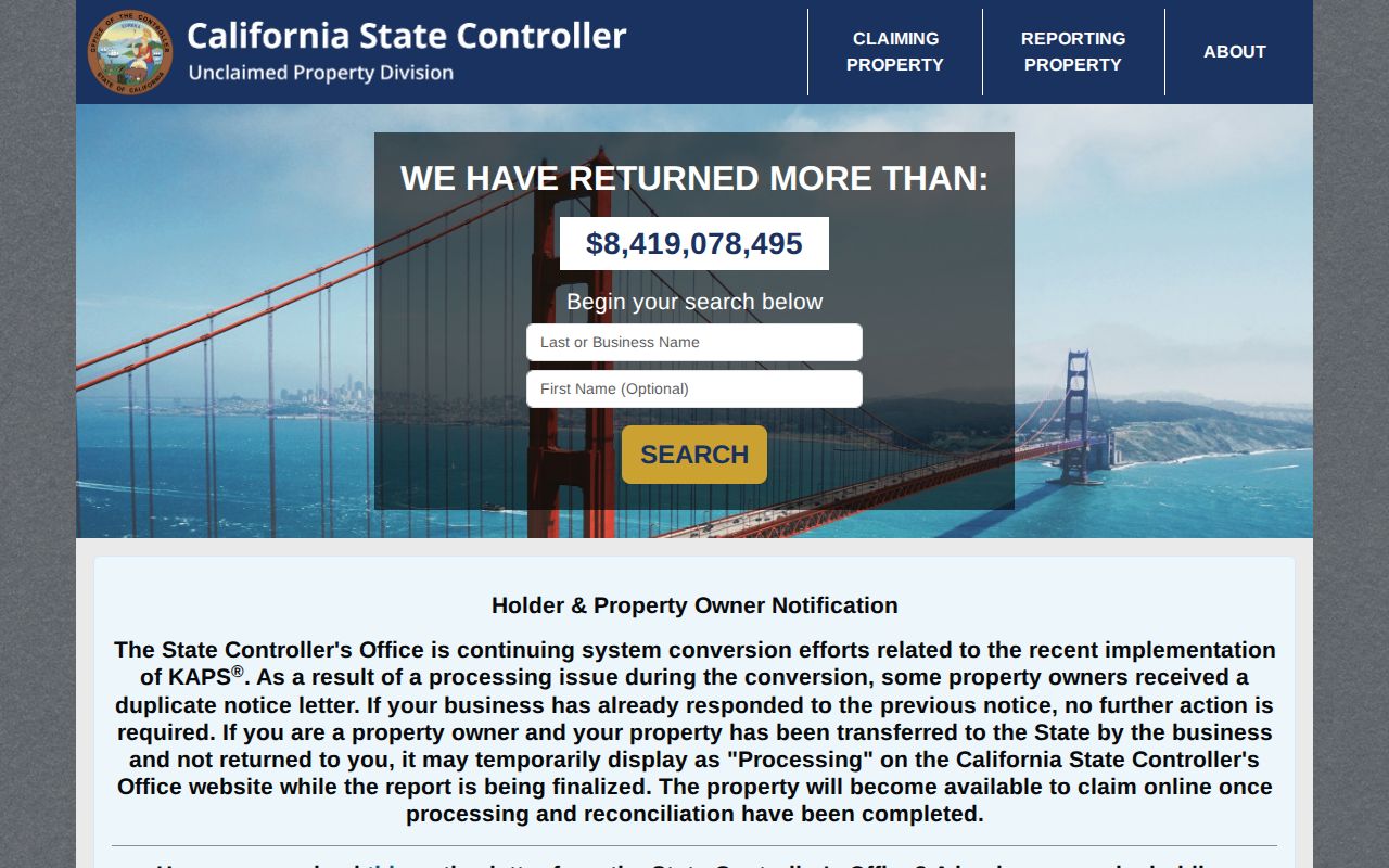
A state search hit can guide a follow-up claim or identity check, but ZIP geography alone does not turn it into residence evidence.
Voter ZIP Data Is Restricted
The Orange County voter self-lookup asks for date of birth, the last four digits of a California ID or Social Security number, and the first three letters of the first name. Its purpose is self-verification. County data orders require an approved use under Elections Code sections 2188, 2194, and 18109, along with an application and wet signature. A request should never be framed as a way to browse Stanton households by ZIP.
Aggregate precinct or city geography can provide civic context. It does not reveal a named person’s address. If a voter record appears wrong, contact the Registrar of Voters and use the official correction path rather than copying a restricted file into a private list.
The county voter-data instructions explain approved purposes and excluded fields.
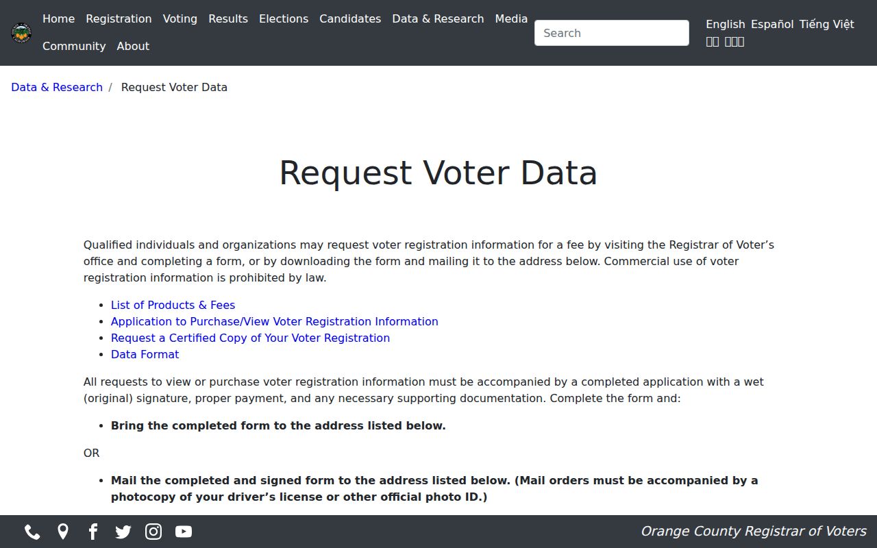
The application screen is a reminder that a ZIP filter does not make restricted voter information public.
Note: Restricted voter data cannot be converted into a public list of Stanton households or neighbors.
Search Historical Stanton Place Names
ZIP codes are modern postal keys. Older Stanton research needs older geographic names. The area was known as Benedict. It incorporated as Stanton in 1911, disincorporated in 1924, and reincorporated on June 4, 1956. The 1950 census calls it unincorporated Stanton. Orange County itself separated from Los Angeles County in 1889, so earlier records can route through Los Angeles County-era custodians.
When a pre-ZIP address does not appear under Stanton, try Benedict, unincorporated Stanton, Orange County, and nearby community labels. Pair the place name with a street, household member, directory year, census enumeration district, parcel map, or newspaper notice. A historical city-directory search is stronger when it follows the place label that existed at the time.
The same rule applies to a modern ZIP search that reaches across a boundary. Keep the USPS result, the county APN, the Stanton jurisdiction, and the record year in separate notes. That small discipline prevents an Anaheim or Garden Grove postal label from being mistaken for a different parcel, and it keeps older Benedict references connected to the present address without rewriting the historical record.
For a deeper address-history check, pair the postal result with the reverse-directory run documented for Stanton from 1955 through 1985, noting the missing 1961 volume. A 1950 census entry may still use unincorporated Stanton, while a later directory may use the incorporated city. That sequence can explain why a household, street, or business appears under changing labels even when the physical location is stable. Record the year beside every ZIP, city, and parcel clue.